
About The Pond
Perkins Pond is a small freshwater pond in Sunapee, New Hampshire, located just off Route 11. It is used year-round for swimming, paddling, fishing, skating, and quiet recreation, and serves as a shared resource for residents and visitors. Like many small, shallow ponds in New Hampshire, Perkins Pond is closely influenced by activity in the surrounding watershed. Protecting water quality and habitat is essential to maintaining the pond’s ecological health and continued use.
An Overview of Perkins Pond
By the Numbers
Size: 157 acres
Elevation: 1082 feet
Maximum Depth: 9 feet
Mean Depth: 4.5 feet
Shoreline: 12,795 feet
Watershed Area: 704 acres
Historical Freeze and Thaw Date
The Perkins Pond Protective Association has kept a log of when the pond’s ice has completely thawed out each year, known as “the Ice-Out” dates, here.
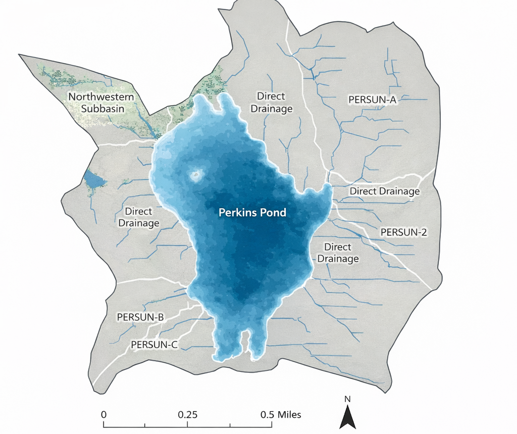
Perkins Pond and its Watershed
A Brief History of Perkins Pond
Geological and Indigenous Context (Before ~1769)
Perkins Pond and the surrounding Lake Sunapee region are situated within a landscape shaped by Pleistocene glaciation. During the Last Glacial Maximum — roughly 15,000–20,000 years ago — the Laurentide Ice Sheet extended over present-day New Hampshire, grinding bedrock and depositing glacial till, boulders, and other features characteristic of deglaciated terrain.
As the climate warmed, these glaciers retreated northward, leaving behind depressions that subsequently filled with water and formed the lakes and ponds of the Lake Sunapee watershed, including Perkins Pond and adjacent water bodies. Glacial erratics and distinct landforms such as drumlins, eskers, and kame terraces in the broader region attest to this ice-age legacy.
Long before European settlement, the broader Lake Sunapee basin was part of the seasonal territory of Indigenous peoples. Algonquian-speaking groups, including the Pennacook and Abenaki, frequented waters around Sunapee and its tributaries for fishing, waterfowl hunting, and travel. The name “Sunapee” itself derives from Algonquian terms meaning “goose water,” reflecting the importance of waterfowl in regional lifeways and linguistic tradition.
This deep time and Indigenous presence underscore that Perkins Pond was part of long-standing natural systems and human landscapes long before colonial land grants or European-American settlement.
Early Colonial Settlement and Naming (Late 1700s–Early 1800s)
By the mid-18th century, the area that would become Sunapee was part of a large colonial land grant issued in 1768 by Royal Governor John Wentworth as the Charter of Saville. Settlement was slow; by 1772, only a modest number of families — largely from Rhode Island and Portsmouth — had established homesteads in the southern reaches of the grant, and the broader region remained heavily forested.
European-American settlement around Perkins Pond specifically appears to post-date these earliest arrivals. Town records show the construction of a dwelling at what is now 140 Perkins Pond Road in 1769, and later local tradition associates the name Perkins Pond with the Perkins family who occupied property there by the 1860s.
During this period, the economy of Sunapee was predominantly agrarian and mill-based. Grist and sawmills on local brooks processed timber and grain, setting the stage for later industrial uses of regional waterways.
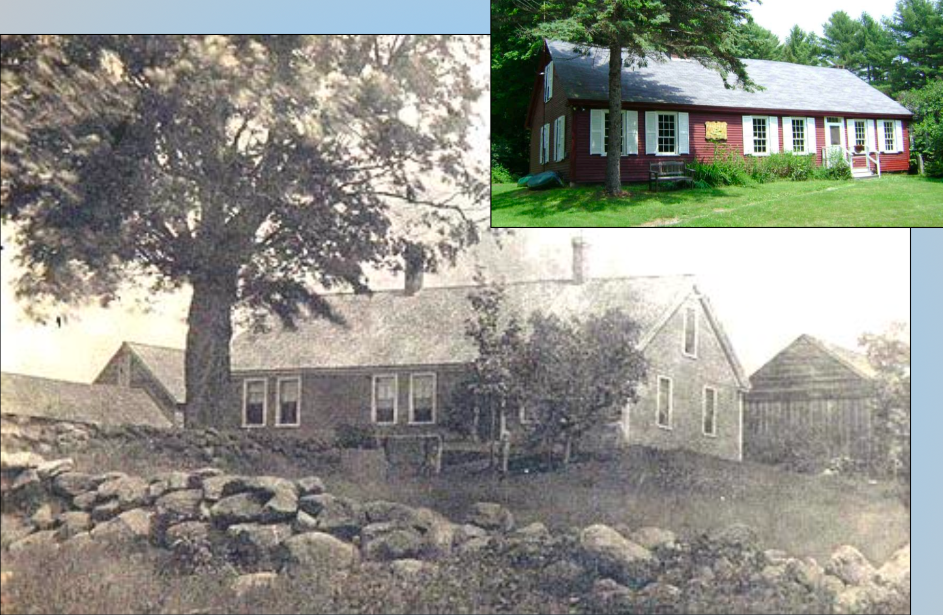
c1799 Samuel Corliss - Enoch Perkins Homestead; photo courtesy of Barbara Chalmers at the Sunapee Historical Society
19th to Early 20th Century: Industrial Use and Early Cottages
In the late 19th and early 20th centuries, the expanding network of roads (including Perkins Pond Road, Old Springfield Road, and Ryder Corner Road) improved access to previously remote corners of Sunapee. Water power remained central to the local economy: Reeds Saw Mill on Reeds Mill Road harnessed flows from nearby brooks, and in dry seasons practitioners stored water in Perkins Pond by altering its natural outflow and constructing a dam with a sluice gate to release water when needed.
Simultaneously, the recreational value of lakes and ponds in the Sunapee region grew. By 1903, several cottages had been erected along the western shore and on the island in Perkins Pond, accessed initially by footpath due to limited road access. This marks the pond’s transition from utilitarian resource to a setting for seasonal habitation and leisure — a pattern that would intensify in succeeding decades.
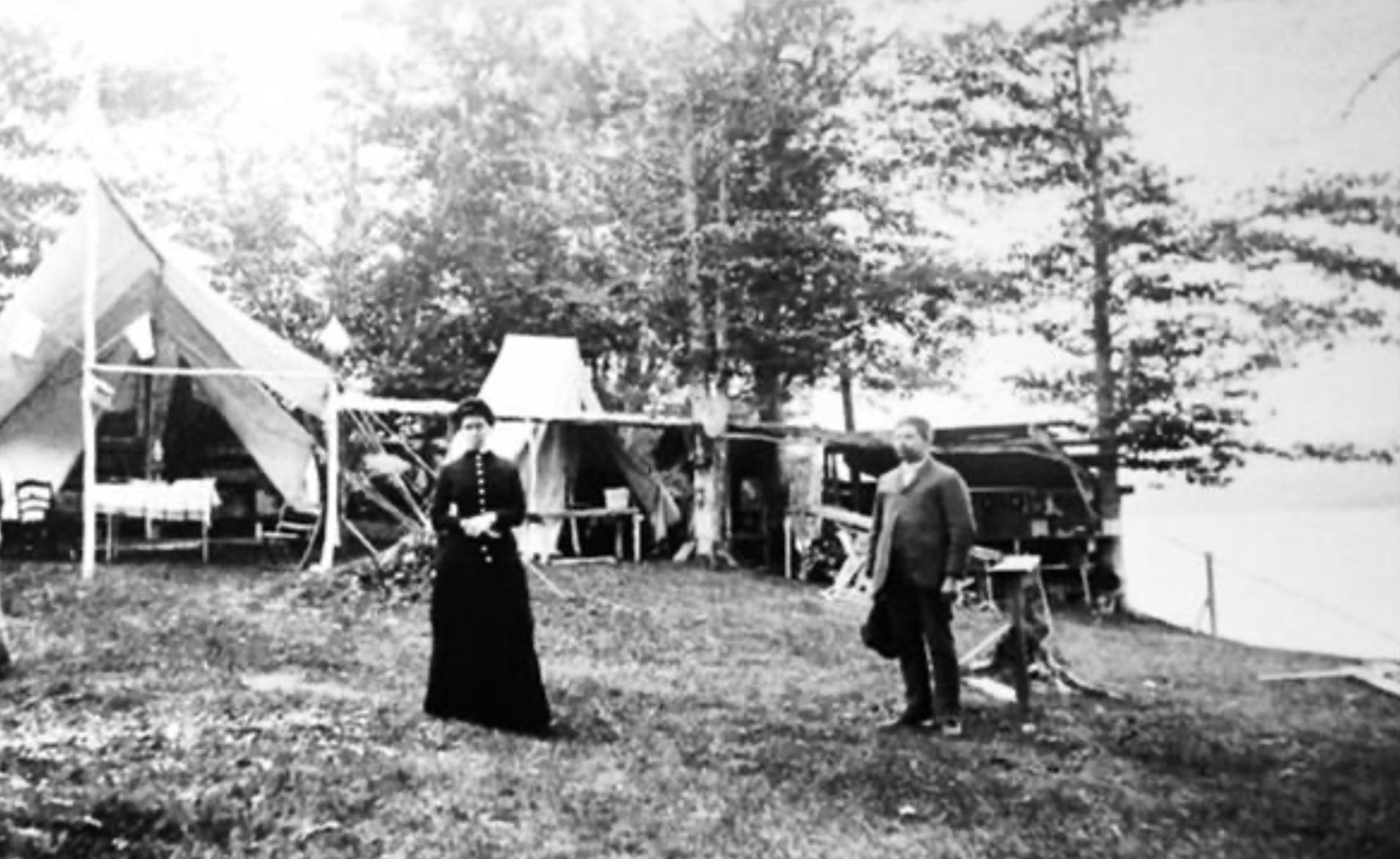
Early camping at Perkins Pond; photo courtesy of Barbara Chalmers at the Sunapee Historical Society
Mid-20th Century Development and Community Formation
The 1938 hurricane dramatically altered the pond’s environs, knocking down vast stands of trees and prompting three sawmill operations to establish log booms along the shoreline. These operations left lasting physical traces in the form of sawdust deposits still visible today.
By the 1950s, Perkins Pond had become a popular locale for seasonal and year-round residents, with about 60 structures around its shorelines, and various social identities emerging among residents — for example, the area at the southern end of Burma Road was known colloquially as “little Finland.”
The Perkins Pond Land Owners Association (later the Perkins Pond Protective Association) formed in the 1950s to steward shared concerns about the pond’s health and community traditions.
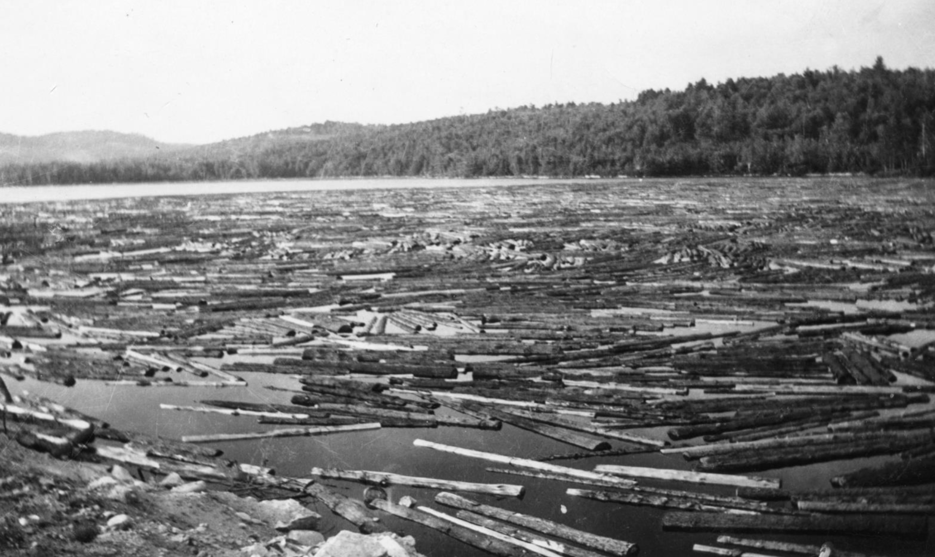
September 1938 Hurricane and Aftermath; photo courtesy of Barbara Chalmers at the Sunapee Historical Society
Late 20th Century to Present: Environmental and Social Evolution
During the 1960s and 1970s, aquatic vegetation such as bladderwort became denser in parts of the pond, complicating navigation and indicating evolving ecological dynamics. By the 1980s and into 1990, the community undertook hydrological modifications such as installing and adjusting culverts to manage water levels and flow, reversing some of the earlier industrial alterations.
In the 2000s, the Perkins Pond Protective Association formalized social traditions, including an annual summer festival that continues to bring residents together. Water quality concerns — including elevated phosphorus loading and sedimentation contributing to decreasing average depth — have been documented as part of recent watershed planning efforts by the Town of Sunapee and state agencies. In 2026, the Perkins Pond Protective Association helped develop the first Perkins Pond Watershed Management Plan.
As of the 2021 cottage census, there are over 100 dwellings on or near Perkins Pond, illustrating the transition from early industrial and agrarian uses to a vibrant residential and recreational landscape.
Join Us!
Be part of the Perkins Pond Protective Association’s work to protect and care for our pond. Click below to learn how you can get involved.